Route
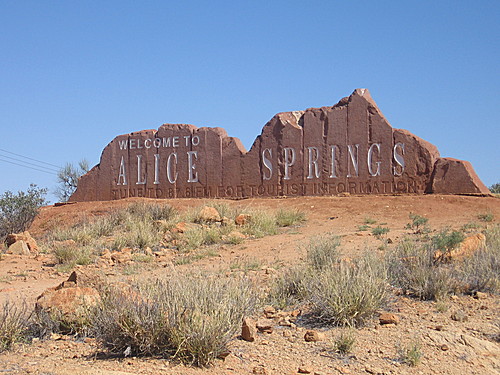
Alice Springs
Alice Springs was settled around a telegraph Station on the Overland Telegraph line between Adelaide and Darwin. It took its name from the wife of Charles Todd, then in charge of Posts and Telegraphs.
Stuart Well: Population 50
90km south of Alice Springs, Stuart well offers meals, a bar, cabin and caravan accommodation and displays a broad history of the area. Jim's Place is run by Jim Cotterill who is one of the region's tourism pioneers. Home of 'Dinky' the singing dingo – that sounds fun!
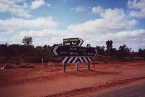
Ayers Rock – The Uluru National Park is located some 250km. west of the Stuart Highway from Erldunda. A little too far for me to make the detour.
Erldunda to Coober Pedy - The trip from Erldunda to Coober Pedy will take me take through some real desert country where at this time of year the temperature could be getting rather hot.
Erldunda: Population 50
A roadhouse, motel complex at the turn-off to Ayers Rock from the Stuart Hwy.
It's perhaps comforting that the road sign outside Erldunda doesn't include distances
Kulgera Population: 50
Last (or first) stop in the Northern Territory and has a hotel, police station and a roadhouse.
Marla: Population 120
Last stop in South Australia before the Northern territory border and has motel accommodation and a caravan, camping park, a hotel, food and petrol. There is a police station and some services.
Coober Pedy: Population 3500
Is situated in the vast Gibber Plains of Central Australia and is the country's largest opal producing town. From here there is 253 km of not a lot until reaching
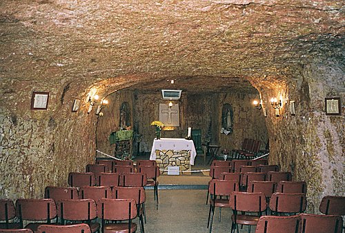
Underground church at Coober Pedy
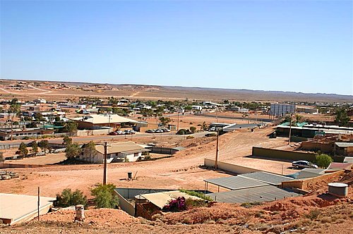
The view over Coober Pedy, where, due to the heat, a lot of buildings are underground
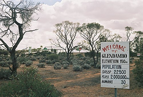
Glendambo: Population 40
Until the bitumen road went through Glendambo, Kingoonya was a popular stop along the dirt road. It is well worth a look to see the old town where there was frequently a cricket match going on in the main street.
Pimba – Woomera: Population 1800
The last major stops from Alice Springs to Adelaide before the major towns of Port Augusta. Until 1980 the road from Pimba to the NT border was loose surface and 'Spud's" pub at Pimba was a popular watering hole for travellers. Woomera is the rocket range for Australia and a prohibited area
Port Augusta: Population 17,000
Situated at the head of Spencer Gulf and is the cross-roads to north-south and east-west in Australia. It is a major touring centre and there is plenty of accommodation and facilities.
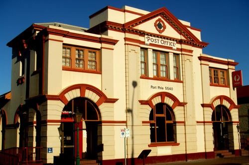
Port Pirie: Population 1500
Just off the highway near Crystal Brook and is a large town with accommodation and all facilities.
Port Pirie to Adelaide - The road from Port Pirie to Adelaide follows the Flinders Ranges to the east and Spencer and then Gulf St Vincent to Adelaide. It passes through increasingly verdant countryside until it reaches the Mount Lofty Ranges and the City of Adelaide's northern suburbs. A pleasant diversion is into the Mount Remarkable National Park near Wilmington, to the Yorke Peninsula at Port Wakefield, or to the Clare Valley and wineries to the east of the Highway.